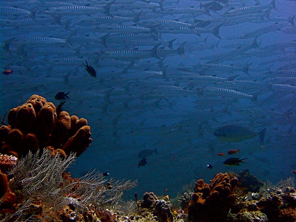
“Smiling with the smiling fishies” by Lee Miller, distributed by the European Geosciences Union under a Creative Commons license.
Jacques Cousteau once said, “I have seen other places like Sipadan, 45 years ago, but now no more. Now we have found an untouched piece of art.”
Indeed, the ‘wall of life’ shown in this picture suggests an untouched world, where schools of fish abound in a pure turquoise ocean.
The waters around Pulau Sipadan (Sipadan Island) are globally recognised as some of the most diverse on the planet, playing host to over 3,000 classified fish and coral species. This rich endemic biodiversity comes from millions of years of geographical isolation; Sipadan, like the Azores and Iceland, is an oceanic island with volcanic origins, formed by the growth of living corals on top of an extinct prehistoric volcano. Today it rises 600 m from the sea floor.
Lee Miller, postdoctoral researcher at the Max-Planck Institute of Biogeochemistry in Jena, Germany, took this picture in 2008, just before starting his doctorate. He describes his experience at Sipadan, “I went to Borneo (Malaysia) in search of the ‘wild’ — it did not disappoint. Along with pygmy elephants, crocodiles, orangutan, sharks, and sea turtles, I caught this glimpse of a school of barracuda off the eastern coast near Sipadan Island. This particular region is one of the only areas like this on Earth, as it combines a volcanic history with a steady nutrient supply from the deep water. This results in this amazing underwater diversity… along with those hundreds of teeth and eyes that are exchanging my stare in this picture.”
The island gets its name from the Siparan people, who used to go there to collect turtle eggs in the 19th century. Today, green and hawksbill turtles are commonly seen in the waters around Sipadan. One of the most unique sites in the area is the Turtle Tomb, an underwater cave system littered by the skulls and bones of turtles that got lost and drowned in its labyrinth of passageways.
Imaggeo is the online open access geosciences image repository of the European Geosciences Union. Every geoscientist who is an amateur photographer (but also other people) can submit their images to this repository. Being open access, it can be used by scientists for their presentations or publications as well as by the press. If you submit your images to imaggeo, you retain full rights of use, since they are licenced and distributed by EGU under a Creative Commons licence.
