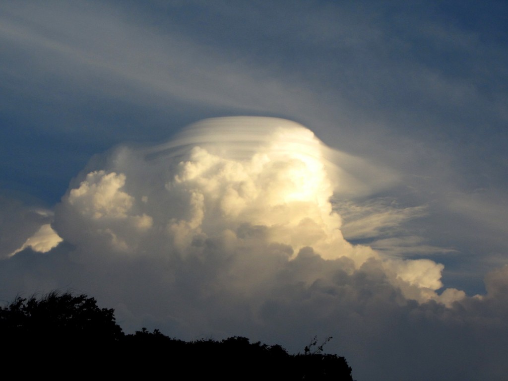
“Cumulonimbus-lenticularis” by Pablo Saavedra Garfias, distributed by the European Geosciences Union under a Creative Commons license.
Lenticular clouds, also known as ‘flying saucer clouds’ or ‘cloudships’, have captured the imagination of humans since Biblical times. Normally aligned at right-angles to the direction of the wind, lenticular clouds are stationary, lens-shaped formations that form at high altitudes. Pilots of powered planes tend to avoid flying near lenticular clouds because of turbulence. Glider pilots, on the other hand, actively seek them out because they tend to form at the top of a rising air mass, large vertical air movements that provide the lift necessary for gliding. ‘Wave lift’, as it is known in the gliding community, is often smooth and strong, and has powered gliders to record breaking distances (over 3,000 km) and altitudes (14,938 m).
Cumulonimbus clouds are tall and extremely dense, and are often responsible for thunderstorms and other inclement weather. They extend high into the sky, their peak easily reaching 12,000 m in altitude and consisting mostly of ice droplets because of the freezing temperatures. Lower levels of cumulonimbus clouds are made of water droplets.
Pablo Saavedra Garfias, a physicist at the University of Bonn, stumbled across this beautiful scene in 2012 during a NASA GPM field experiment at the Brazilian Space Agency’s Alcântara launch center. He describes the double cloud formation overhead in the context of his study, “The picture is a synthesis of a thunderstorm under formation over the ocean, far away from the experimental site. The nimbus cloud grew to an altitude of around 8 km. The lenticularis cloud is usually caused by a moist stream of air flowing over a high mountain peak, but in this case was formed over a cumulonimbus cloud as a proxy of a high mountain. The scene is therefore unusual because it features a combination of both nimbus and lenticularis clouds, the former causing the latter. This type of scenario is more frequent in the tropics, where high moisture levels feed into the convective air motion in order to form huge cloud systems. The resulting precipitation was the main scientific subject during this field campaign. The better understanding of this kind of system will help us better understand precipitating clouds from satellite observations.”
Garfias was quick to capture the fleeting scene, “The phenomenon lasted only a few minutes, not enough to allow me to find an optimal position to capture the picture. After some minutes the lenticularis vanished and only the cumulunimbus stayed for a while, but no precipitation was initiated. I used a Canon PowerShot SX1 IS (1/250 second exposure time, aperture F4.5, focal length 23.8 mm).”
Imaggeo is the EGU’s online open access geosciences image repository. All geoscientists (and others) can submit their images to this repository and since it is open access, these photos can be used by scientists for their presentations or publications as well as by the press and public for educational purposes and otherwise. If you submit your images to Imaggeo, you retain full rights of use, since they are licensed and distributed by the EGU under a Creative Commons licence.
