Nore Praet, a PhD student from Ghent University in Belgium, brings us this week’s Imaggeo on Mondays. She sets the scene for an investigation into past earthquakes and explains how peering through a lake’s icy surface and its murky waters, and into the sediment below can help scientists find out more about the impact of earthquakes in the future…
Early this year, I set off with a group of scientists (including Koen De Rycker, Maarten Van Daele and Philipp Kempf) from the Renard Centre of Marine Geology to conduct fieldwork in South-Central Alaska. The reason for our stay was the search for past megathrust earthquakes (earthquakes produced by the subduction of an oceanic tectonic plate under a continental plate), which had an unusually high magnitude and destructive power.
The most recent Alaskan megathrust earthquake was the Great Alaskan Earthquake in 1964, which represents the second largest earthquake ever instrumentally recorded (9.2 on the moment magnitude scale). In order to have an estimate when such a large earthquake may strike again, we need to study the recurrence pattern of past earthquakes. Since megathrust earthquakes typically have recurrence periods of several centuries, historical archives will not suffice. This is where natural archives, like lake sediments, come in. These records have the advantage of going much further back in time, and they are what brought us to Alaska’s Eklutna Lake.
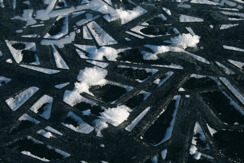
Zooming in on individual ice crystal aggregates (few centimeters across) and geometric frost patterns on the frozen surface of Eklutna Lake, Alaska. (Credit: Nore Praet via imaggeo.egu.eu)
Lake sediments can contain very distinct earthquake traces because seismic shaking produces underwater landslides that leave well-defined sediment deposits in the lake basin.
Long sediment cores, extending some 15 metres through these deposits, make it possible to construct a palaeoseismic record. From this we can make an estimate of the recurrence rate of megathrust earthquakes. This will be crucial for understanding seismic hazard in South-Central Alaska and, in particular, in the densely populated city of Anchorage.
This photo, taken in early February, captured the moment where we officially started the fieldwork, after checking the thickness of the ice and its stability.
The constant struggle with the almighty Alaskan cryosphere was the real common theme during the fieldwork. The freezing cold, together with ice formation on the coring equipment, seriously hampered the efficiency of the coring operation. It took some time to accept these conditions and adjust to the demanding laws of this harsh wilderness, but once you are willing to invest the energy into working here, every day nature surprises you with her astonishing beauty.
By Nore Praet, Ghent University
Imaggeo is the EGU’s open access geosciences image repository. Photos uploaded to Imaggeo can be used by scientists, the press and the public provided the original author is credited. Photographers also retain full rights of use, as Imaggeo images are licensed and distributed by the EGU under a Creative Commons licence. You can submit your photos here.